Internet and History of Moscow: Online exhibition of unique city maps launched
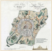
The online exhibition "Moscow Cartography" presents the development of the capital from Ancient Rus' to the XX century. A collection of drawings belongs to the "Mosstroyinform" - a state budgetary institution subordinate to the Department of Urban Development Policy. The virtual exposition is available on the portal of the "House on Brestskaya" Congress and Exhibition Complex.
The exhibition includes seven sections. The "Antique Moscow Plans" contains the city schemes of the XI–XVII centuries. The "Moscow Illustrated Maps" section releases graphic materials. The section "City Plans and Schemes of the Soviet Period" provides drawings showing the XX century construction boom.
The section "General Plan of Moscow Development" features a document of 1935. It is a project of the future capital. The general plan for ten years included the entrance of new districts, building of residential quarters, construction of the Volga-Moscow Channel, development of the metro and ground transport networks. Guidebooks maps with public transport routes, theatres, museums and attractions are available in the "Thematic Plans and Schemes" section.
Besides, the section "Moscow Outskirts" releases the maps of regional settlements. The "Transport" section presents drawings of tram lines in 1936-1938.
Maps illustrate the changes in borders of Moscow and city districts, development of the road network, appearance of new districts, embankments, bridges and parks. All sections have explanatory notes. After viewing the maps, it is possible to test the knowledge in the online quiz.
Moscow also has an interactive map. It covers the entire territory of the capital, including the Troitsky and Novomoskovsky districts, and gives an idea of the city and its layout. The map allows getting information about road reconstruction, new and constructing metro stations, planned transport hubs, unique urban planning facilities and much more.

