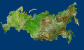
Territory of Russia: Extremely-detailed digital map of Russia to create
Roskartografiya and the Scientific Center for Geodesy and Cartography will create a digital detailed map of Russia. Within five years, they will develop a three-dimensional map of the country, said Sergey Karutin, General Director of Roskartografiya.
According to him, planes and drones will make ultra-high-precise photographs (resolution from 14 centimetres to half a meter) of inhabited territories.
"The last work of the same kind took place in Russia in the 1960s-1980s", said Karutin.
It will take several years to create the card. Then it will be improved every 2-3 years.
In parallel, Roskartografiya is performing laser scanning of Russian territory. "The joint use of laser scanning and aerial photography gives us an immediate digital land configuration", said Karutin.

