| Description |
|
| |
|
|
|
|
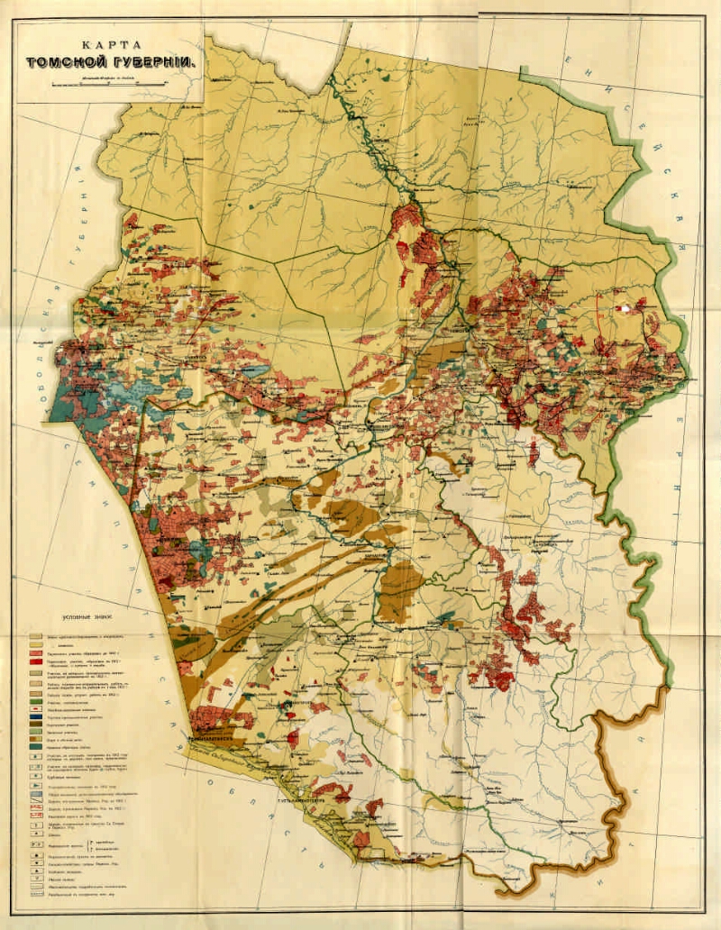
Map of the Tomsk province [Maps]. - [1: 168,000], 40 versts in inch (1, 7 km in 1 cm). - [St. Petersburg: Resettlement management, after 1911]. - 1 in.: Color. ; 64x82 (68x86). - Cartographer. grid through 2 °. - Installed. debt. from Pulkovo. - Without relief. - Usl. signs: the land of peasant watchdogs, foreigners, Cossacks, resettled. sections, image. before and in 1912, the district will arrange for it. works, g. settlements, bora and forest dachas, public-obrich. articles, wells, hydraulic engineering. explorations, reservoirs, roads, honey. points, relocated. points of movement, warehouses, etc.
.
|
|
|
|
1. Territory of Russia (collection). 2. The people (the collection). 3. Novosibirsk region: pages of history (collection). 4. Tomsk region: pages of history (collection). 5. Kemerovo region: pages of history (collection). 6. Settlers - Tomsk Province - Maps. 7. Tomsk Province - Maps. 8. Geographic maps. |
|
|
BBK 26.89 (253.3) i64
BBK 63.3 (28-8Tom) 53n64
|
|---|
|
|
Source of electronic copy: Omsk GONB
Location on
Omskaya GONB
|
|