| Description |
|
| |
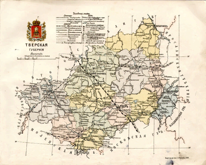
Tver Province. Map. [1: 189,000]. |
|
|
Tver Province [Maps]. - [1: 189 000], 45 miles in English. inch (1, 9 km in 1 cm). - St. Petersburg: D. Rudnev's cartographic institution, [1913]. - 1 in.: Color. -
Cartographic grid in 1 °.
Without relief.
Conditional signs: borders: state, provincial and regional, county and county; roads: railways, highways with bridges, postal stations, transport, lanes, bunkers; telegraph and station; water: rivers and lakes; settlements on administrative division and number of inhabitants (9 gr.), commercial and industrial points; factories and plants.
The coat of arms of the Tver province.
In the book: Russia. Geographical description of the Russian Empire in the provinces and regions with geographical maps / Ed. AE Ryabchenko. T. 1: European Russia, Part 4: Ozernaya oblast. [SPb.]: Ed. on means Vel. book. Mikhail Alexandrovich, type. "Thrift," [1913]. Map No. 13
. |
|
1. Territory (collection). 2. Tver region: pages of history (collection). 3. Tver Province - Geography - Maps. 4. Geographic maps. |
ББК 26.89 (235.44) я64
|
|---|
An electronic copy source: Tverskaya OUNB
An Original Storage Location: Тверская ОУНБ |
|