| Description |
|
| |
|
|
|
|
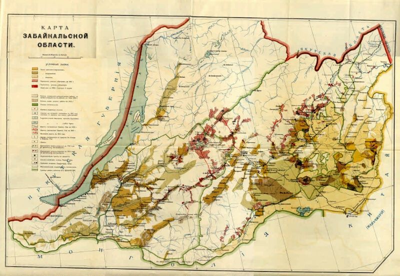
Map of Trans-Baikal region [Maps]: [with changes]. - [1: 168,000], 40 versts in inch (1, 7 km in 1 cm). - [St. Petersburg: Resettlement management, after 1911]. - 1 in.: Color. ; 49.5x77.5 (53.5x80). - Cartographer. grid through 2 °. - Installed. debt. from Greenwich. - Without relief. - Usl. signs: the land of old peasants, foreigners, Cossacks, resettled. sections, image. before and in 1912, the district will arrange for it. works, railway vehicles. settlement, wells, hydraulic engineering. exploration, roads and roads, honey. points, relocated. points of movement, agricultural production; warehouses, the borders of the land of His Majesty's Cabinet, etc.
.
|
|
|
|
1. Territory of Russia (collection). 2. Transbaikal Region - Geography - Maps. 3. Geographic maps. |
|
|
BBK 26.89 (253.5) i64
|
|---|
|
|
Source of electronic copy: Omsk GONB
Location on
Omskaya GONB
|
|