| Description |
|
| |
|
|
|
|
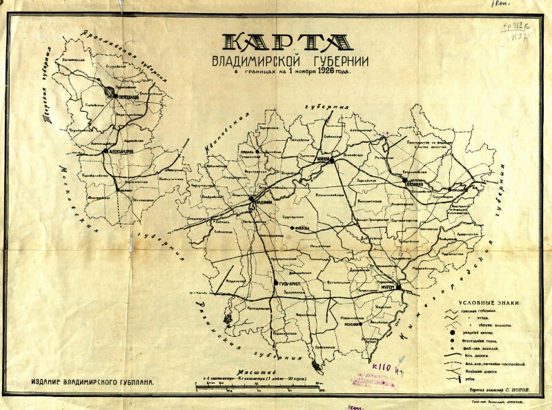
Map of the Vladimir province [Map]: in boundaries on November 1, 1926 / surveyed surveyor S. Popov. - [1: 840,000], 1 inch 20 versts (8.4 km in 1 cm). - Vladimir: edition of the Vladimir Gubplan, type-lit. Vladizdat "The Call", [192-]. - 1 to. ; 35 x 48. - Without the net. - Without relief
.
|
|
|
|
1. Vladimir Province - Geography - 1920's. - Maps. 2. General geographic maps - 1926. 3. Geographic maps. |
|
|
ББК 26.89 (235.44) я64
|
|---|
|
|
The source of electronic copy: Vladimir OUNB
The original storage: Владимирская ОУНБ
|
|