| Description |
|
| |
Lena, the river. Atlas. [1: 25,000]. |
|
|
|
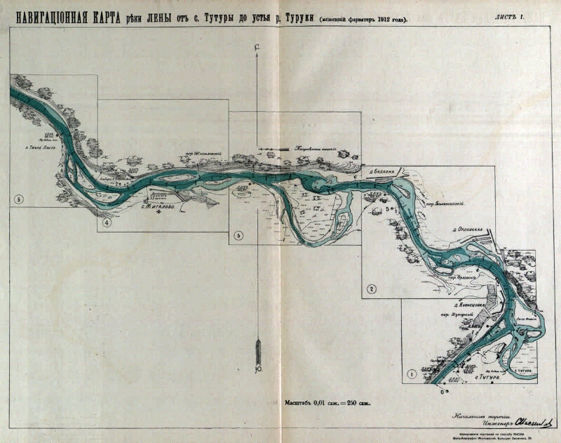
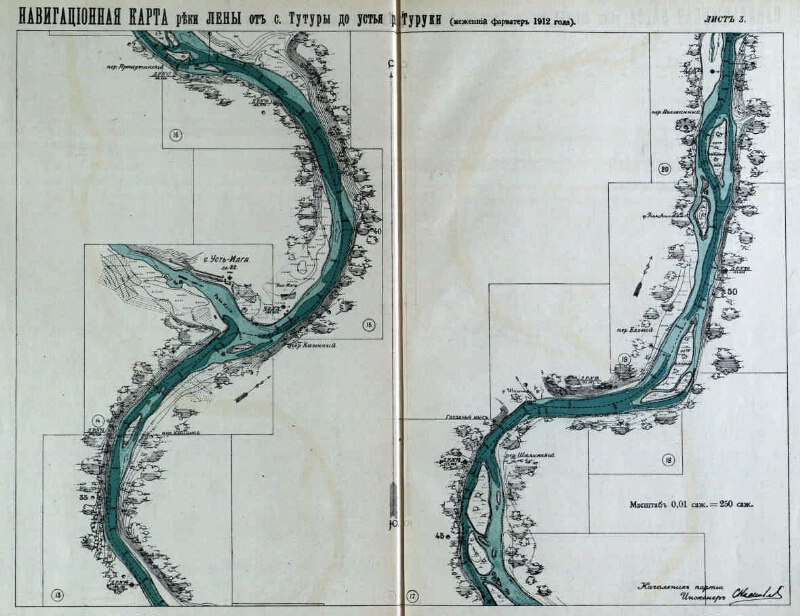
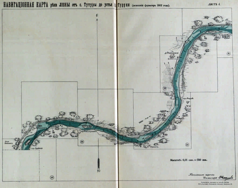
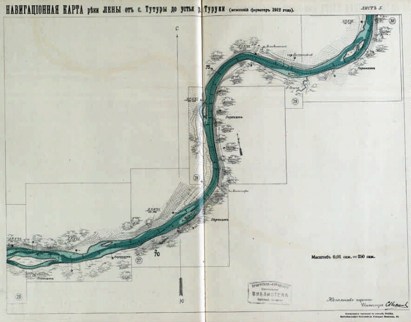
The navigational map of the Lena River from. Tutures to the mouth of the river. TURUKI [Maps] / beg. party engineer. SA Vasiliev; M.P.S. - [1: 25,000], 0.01 carbon black. = 250 soot. - [St. Petersburg: Department of Inland Waterways and Highways], photo-printing of Kozlovskaya, [after 1913]. -1 at. (21 liters, 1 liter of text, 1 liter of conventional text): color. ; 36x26
. |
|
I. Vasiliev, S.A.1. Territory of Russia (collection). 2. Lena, the river (Siberia Eastern) - Delta - Navigation maps. 3. Navigation maps. |
BBK 26.89 (2285.4)
|
|---|
Source of electronic copy: Irkutsk OGUNB
Location on
Irkutsk OGUNB |
|