| Description |
|
| |
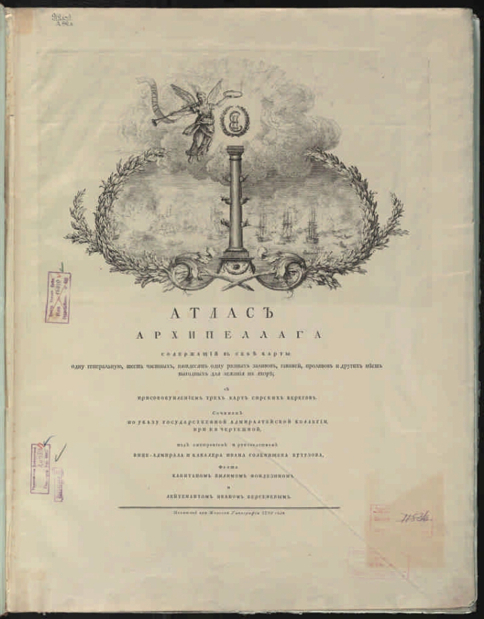
The Mediterranean Sea (eastern part). Atlas. |
|
|
The Atlas of the Archipelago contains maps: one general, six private, fifty one different bays, harbors, straits and other places favorable for lying at anchor; with the addition of three maps of the Syrian coasts. : Compiled by the decree of the State Admiralty College, under her drawing, under the supervision and leadership of Vice Admiral and Chevalier Ivan Golenishchev Kutuzov, fleet captain Wilim Fondezin and Lieutenant Ivan Bersenev. - [The scale is different]. - [Saint Petersburg]: Printed at the Naval Printing Office, 1798. - 1 atlas (title page, [3] sheet of text, 40 expanded map sheets); 64x48 cm. -
In the binding. On the cover is a sticker: "Atlas of the Archipelago."
Contains 58 engraved cards on 40 unfolded sheets. - Index: "Catalog of maps."
. |
|
I. Golenishchev-Kutuzov, Ivan Logginovich (1729-1802). II. Russia. The Admiralty College. Territory (collection). 2. Russia and the countries of the world (collection). 3. The Aegean Sea - Atlases. 4. Geographic maps. |
ББК 26.89 (92) я64
|
|---|
Source of electronic copy: PB
Location on the original: Administration of Navigation and Oceanography of the RF Ministry of Defense |
|