| Описание |
|
| |
Purdy, John
|
|
|
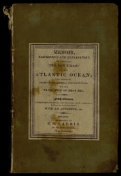
Memoir, descriptive and explanatory, to accompany the new chart of the Atlantic ocean: and comprising instructions, general and particular, for the navigation of that sea : Also, 1. Tables of the determined positions of all its principal points, &c., from Greenland to the equator, with the authorities; illustrated by notes: including remarks on the variation of the compass. 2. A copious explanation of the winds, tides, currents, &c.; and of the different Passages over the Atlantic and equator, as controlled by these phaenomena: including a general tide-table. 3. Descriptions of the coasts and islands; particularly of Africa, and of the Azores, Madeiras, Cape Verde, and Bermudas', islands. 4. A description of rocks, shoals, and vigias, or supposed dangers; with the authorities on which they have been inserted in the chart : With an appendix: containing hints and remarks on general nautical practice; viz. a ship's reckoning; latitude; longitude; chronometers; the compass; variation; temperature of the sea, mode of ascertaining currents; marine thermometer and barometer; and the subjects therewith connected / By John Purdy, hydrographer. - Fifth edition; corrected and materially improved: including, with numerous additions, those formerly given from the voyages of commodore Krusenstern and captain Lisiansky: of captains M. Flinders, Wm. H. Smyth, and Basil Hall, R.N.; and of the baron Alex. de Humboldt; also from the papers of Major Rennell, and from many original communications, by capt. and Livingston, of Glasgow, capt. Ab. Bristow, other commanders in the merchant-service, and several officers in the Royal navy. -London : Printed for R.H. Laurie, chart-agent, by appointment, to the admiralty, &c., 1825. -VIII, 309, [1], 16 с. : табл., ил.. -
На обл. изд-во: Published by R.H. Laurie.
Библиогр. в подстроч. примеч.. - Экз. деф.: с. 121 пронумерована как с. 112.
. |
|
1. Территория (коллекция). |
|
|
|---|
Источник электронной копии: ПБ
Место хранения оригинала: ЦВМБ |
|